
Precision at Scale: How RTK Drones are Changing Construction Site Measurements
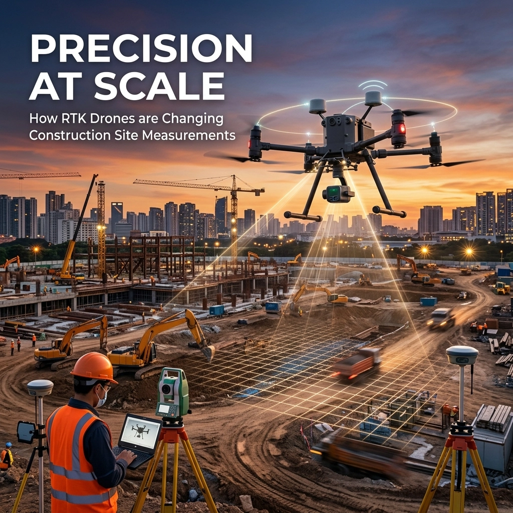
What RTK Drones Mean for Construction Teams
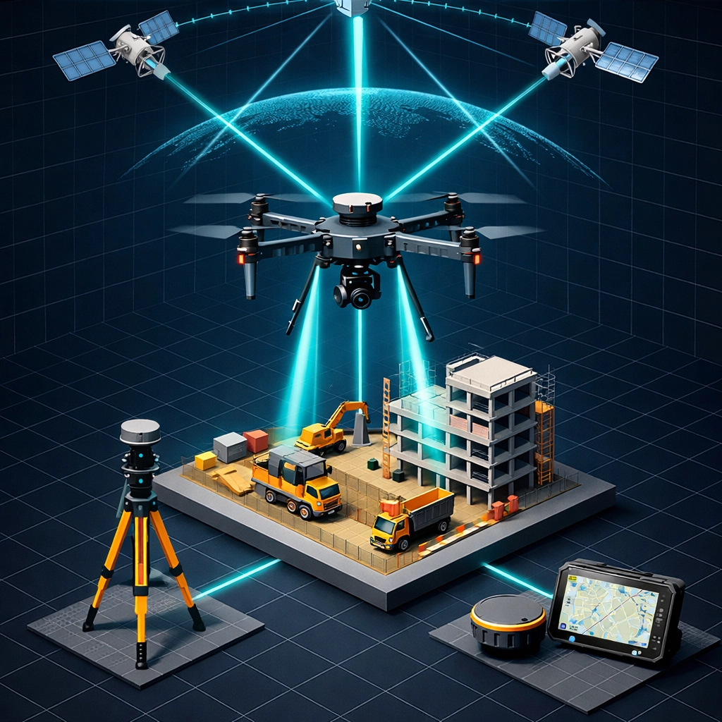
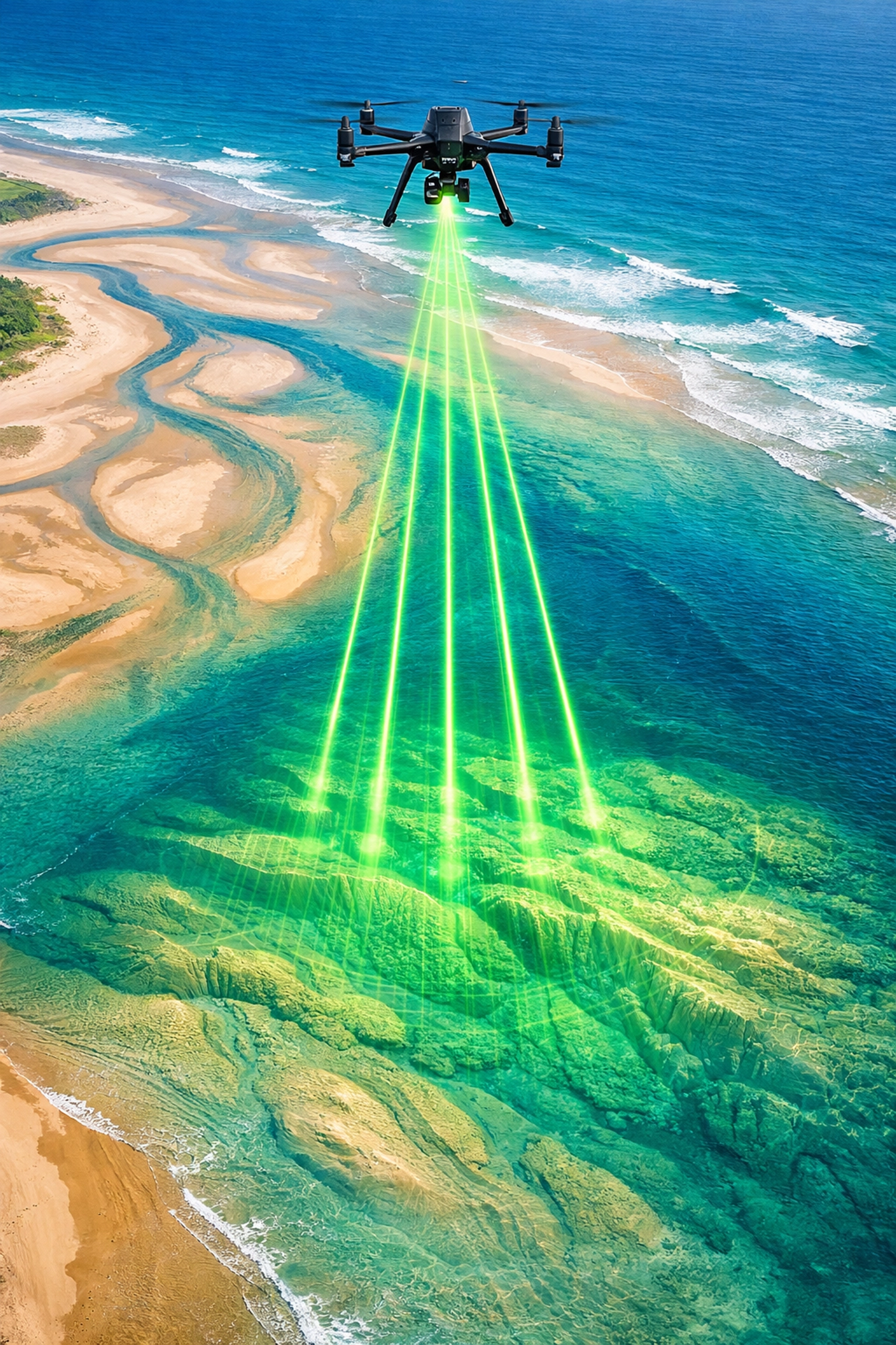
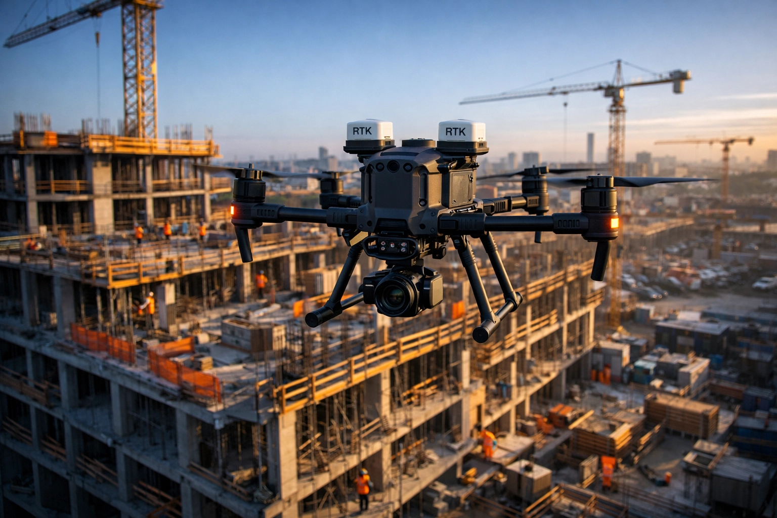
RTK stands for Real Time Kinematic. In construction, that matters because it allows a drone to capture location data with centimeter-level accuracy instead of relying on standard GPS alone. An RTK drone receives correction data from a base station or network source while it flies, which helps reduce positioning error and produces survey-grade results for mapping, measurement, and documentation.
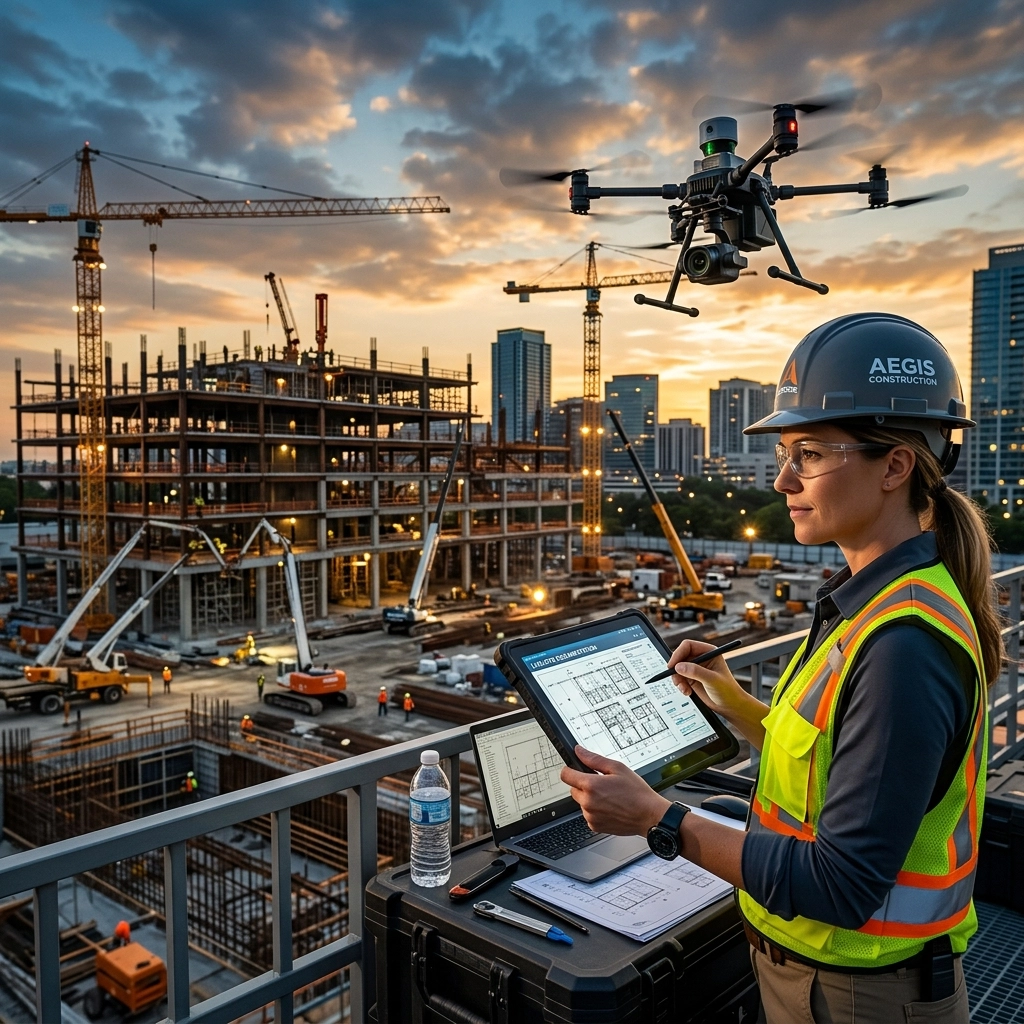
For a construction team, that higher level of precision is not just a technical detail. It changes how confidently you can use aerial data in day-to-day decisions. When project managers, owners, engineers, and superintendents need to verify grades, compare site conditions over time, or measure stockpiles, more accurate positioning means fewer questions and less time spent double-checking the data.
Why Centimeter-Level Accuracy Matters
The biggest advantage of RTK drones is consistency. On active jobsites, small measurement errors can create bigger problems later, especially when those errors affect earthwork quantities, elevation checks, utility placement, drainage planning, or progress verification. RTK technology helps reduce that risk by improving the accuracy of every image and data point collected during flight.
That centimeter-level accuracy is especially useful when teams need repeatable measurements across multiple site visits. If you are documenting excavation progress this week, checking grading next week, and comparing conditions again next month, RTK data gives you a more dependable record from one flight to the next. That makes it easier to track change over time and communicate clearly with stakeholders who need reliable information.
How RTK Improves Site Measurements
Traditional drone workflows often depend heavily on ground control points to improve accuracy. Ground control can still play an important role, but RTK drones reduce the amount of field setup required on many projects. That means crews can collect high-accuracy data faster, with less disruption to the site and fewer delays tied to placing and surveying targets.
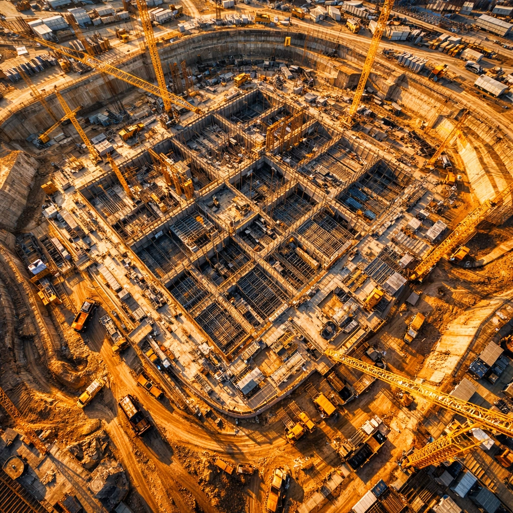
For construction professionals, this leads to a more efficient workflow. Instead of waiting on extensive setup before every mission, teams can move more quickly from flight planning to usable outputs such as orthomosaics, surface models, topographic maps, and quantity reports. The result is faster access to information that supports layout verification, earthwork tracking, and overall project coordination.
The Impact on Project Timelines
Accurate data supports faster decisions. When measurement information is dependable, project teams can identify issues earlier, confirm completed work with more confidence, and avoid unnecessary rework. RTK drone data helps shorten the gap between site activity and actionable reporting, which is critical when schedules are tight and multiple trades are moving at once.
This is one reason RTK drones are becoming so valuable for construction progress documentation. They help teams verify what has changed, where it changed, and whether the work aligns with plan conditions. That clarity can improve coordination meetings, support owner updates, and keep project timelines moving by reducing uncertainty around current site conditions.
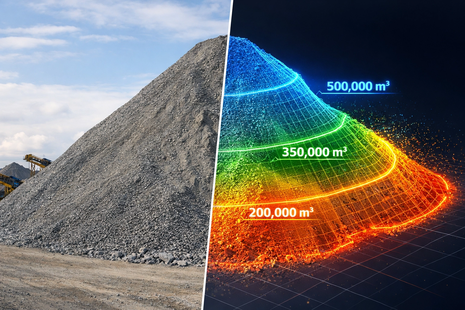
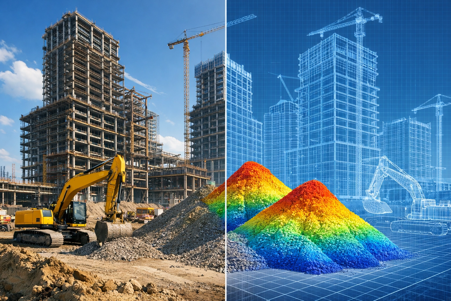
Better Volume Tracking and Verification
RTK drones are also a strong fit for volumetric analysis. Whether the goal is measuring stockpiles, tracking cut and fill, or documenting material movement over time, higher positional accuracy improves confidence in the numbers. For contractors and owners, that can support better forecasting, clearer reporting, and more reliable billing verification.
On large projects, these calculations are often tied directly to schedule and cost control. If material quantities are off, production planning can be affected. When drone data is captured with RTK accuracy, teams have a better foundation for monitoring progress and validating how much work has actually been completed.
Quality Control Across the Jobsite
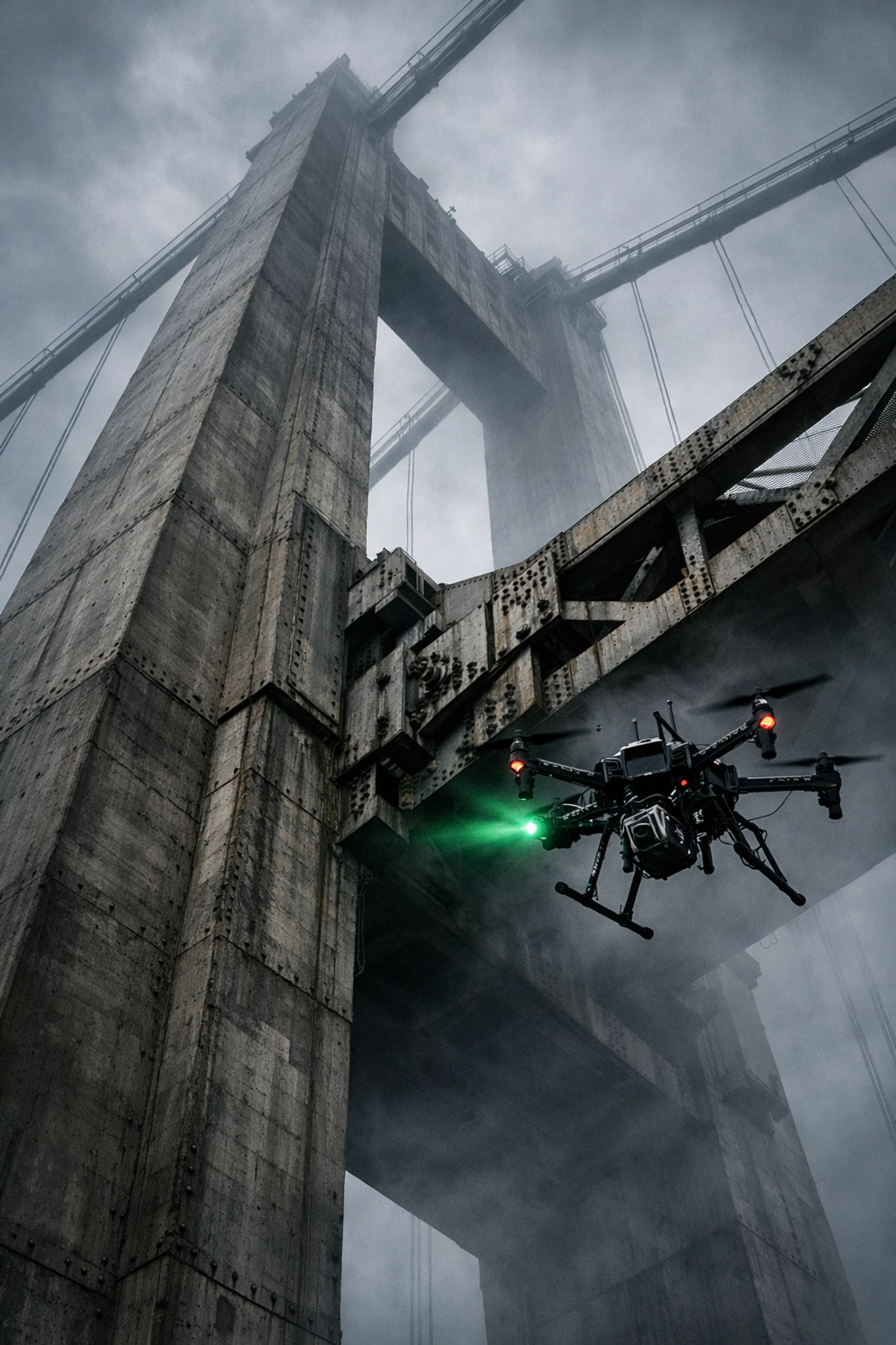
Construction teams also use RTK drone data for verification and quality control. Accurate aerial mapping makes it easier to compare design intent with field conditions, review site alignment, monitor access roads, document utilities, and create a dependable visual record of the project. That is useful not only during active construction, but also for closeout, as-built documentation, and long-term asset management.
Because RTK workflows support repeatable capture, they are also effective for ongoing progress monitoring. A consistent aerial record helps everyone see how the site is developing and makes communication simpler across internal teams, clients, and outside consultants. When the documentation is clear and measurable, project conversations tend to move faster.
Why Experience Still Matters
RTK technology is powerful, but the hardware alone is not the whole story. Construction drone operations still depend on flight planning, airspace awareness, site safety, data handling, and a clear understanding of how the imagery will be used after capture. That is why the operator matters just as much as the platform.
Eyesabove Imagery Services brings that operational experience to construction and infrastructure projects through consistent documentation workflows and FAA-certified pilots. Our team understands how to collect imagery and measurement data in a way that supports real project needs, whether the goal is progress tracking, inspections, mapping, or stakeholder reporting.

What Teams Receive from an RTK Drone Workflow
Once the flight is complete, RTK data can be processed into outputs that fit existing construction workflows. That may include orthomosaic maps, point clouds, digital surface models, terrain models, quantity calculations, and reporting files that can be shared with project teams.
At Eyesabove Imagery Services, that process is designed around construction documentation. Clients receive high-resolution imagery and organized deliverables through a secure workflow that supports project visibility from early site work through closeout.
Where RTK Drones Fit Best
RTK drones are especially useful on projects where measurement accuracy, repeatability, and speed all matter at the same time. That includes commercial development, infrastructure work, utility corridors, road projects, bridge support documentation, site grading, and large-scale earthmoving.

Final Takeaway: RTK drones give construction teams a more accurate way to measure, document, and monitor jobsites. The key benefit is better data that helps teams stay aligned and make schedule-critical decisions with more confidence.
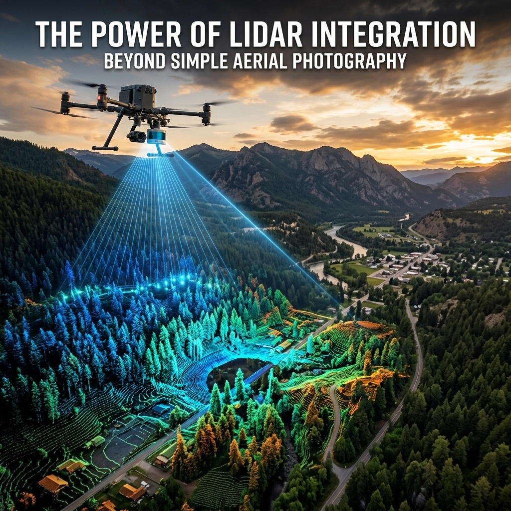
LiDAR Integration for Construction Planning and Documentation
Why LiDAR Matters on Construction Sites
Construction teams need more than visual updates. LiDAR captures dense spatial data in X, Y, and Z coordinates, producing a precise digital record of terrain, structures, and stockpiles. For owners and project managers, this means site conditions can be reviewed as measurable geometry rather than just photos.
At Eyesabove Imagery Services, LiDAR is paired with professional aerial imagery to give stakeholders both visual context and spatial accuracy. Photos help communicate progress, while LiDAR supports measurement and comparison.

LiDAR Compared to Standard Photography
Traditional photography depends on reflected light and visual features. In environments with heavy shadows or vegetation, it can be less effective. LiDAR actively measures distance using laser pulses, capturing surface geometry with consistent accuracy that photography cannot match.
This allows teams to quantify elevation, volume, and shape—turning observation into measurement-based decision-making.
Planning with Better Site Intelligence
During preconstruction, LiDAR helps establish reliable baseline conditions. It supports topographic mapping and earthwork estimation, allowing teams to identify constraints sooner and reduce surprises later in the schedule.
Monitoring Progress with Measurable Data
LiDAR extends monitoring from visual progress to measurable progress. Repeated scans allow teams to track site changes, verify installed work, and compare actual conditions against plans. This helps identify discrepancies before they become expensive field issues.
Documentation That Holds Long Term Value
Construction sites change quickly, and many critical conditions are soon buried or covered. LiDAR preserves those moments in a format that can be revisited for as-built documentation, utility records, or renovation planning years later.

Integrating LiDAR into Project Workflows
LiDAR is most effective when integrated into the overall strategy. Scans are processed into point clouds and terrain models that fit the project team's needs, informing planning meetings and owner updates. Eyesabove Imagery Services supports this with FAA-certified operations and professional capture from both the air and ground.
Conclusion: LiDAR offers a practical advantage for planning, monitoring, and long-term records. Combined with professional imagery, it creates a documentation system that is visual, measurable, and useful throughout the project life cycle.
The Ultimate Guide to Modern Construction Site Documentation
Modern construction site documentation is no longer optional—it's how projects stay aligned and avoid confusion. At Eyesabove Imagery Services, we create a reliable visual record using consistent aerial and ground capture, delivered through a secure digital portal.
Consistency is key. Weekly progress photos from repeatable positions allow teams to identify slowdowns earlier and keep stakeholders informed with useful project intelligence.
Weekly Progress Photos and Aerial Drone Inspections
Weekly photos create a visual timeline everyone can understand. Superintendents use them for sequencing, while owners use them to monitor milestones. Aerial inspections add safety by documenting roofs and high façades without needing ladders or lifts.
Why the Digital Portal Matters
A central digital portal keeps records available to the right people. Users can log in and view imagery by date or milestone, which is essential for distributed teams. Eyesabove’s live portal allows teams to move from reactive reporting to proactive visibility.
Documentation Beyond Progress Tracking
Construction imagery also supports investor presentations, safety reviews, and marketing. Treating visual documentation as project infrastructure ensures that dependable information is always available when it’s needed most.
What to Look for in a Documentation Partner
A partner should provide dependable schedules, clear image quality, and a deep understanding of construction needs. Eyesabove Imagery Services provides FAA-certified pilots and documentation workflows designed for active jobsites.

Summary of Services
- Weekly Progress Photography: Foundation documentation, MEP rough-ins, and site logistics monitoring.
- Aerial Drone Inspections: Structural assessments, roof analysis, and safety hazard identification.
- Digital Portal Architecture: Secure cloud storage, role-based access, and interactive site maps.
- Promotional Visual Media: High-definition marketing content and project milestone highlights.
Good documentation reduces uncertainty and improves transparency. For a professional way to document your next project, Eyesabove Imagery Services offers the visibility you need without the complexity.